Trails
Richmond can boast being in the middle of some of the most diverse trail types available. Along with trails in downtown Richmond, there are a variety of other trail systems which can be found in the surrounding areas including the counties of Henrico, Powhatan, Goochland, and Chesterfield.
Inside the city limits, Richmond parks provide over 20 miles of true singletrack which are unique to a city of its size. Short drives to state and county recreation areas offer many different multi-use and bike-only trail types. Pocahontas State Park hosts over 100 miles of trails which include a variety of single track, gravel, and 7 miles of handcycle trails. Check out the below maps to learn more about mountain biking opportunities in Richmond and the surrounding areas!
The below maps link to the TrailForks website which is the largest and most comprehensive mountain bike trail database. Owned and hosted by Pinkbikes, the TrailForks database contains details for over 80,000 mountain bike trails around the world. TrailForks is a site that allows local trail associations, like rvaMORE, to have the control to approve & curate the trail data. Check out the powerful TrailForks App which allows you to download offline trail maps and can be used with GPS to show your current location.
James River Park System on Trailforks.com
Powhite Park on Trailforks.com
Pocahontas State Park on Trailforks.com
Deep Run Park on Trailforks.com
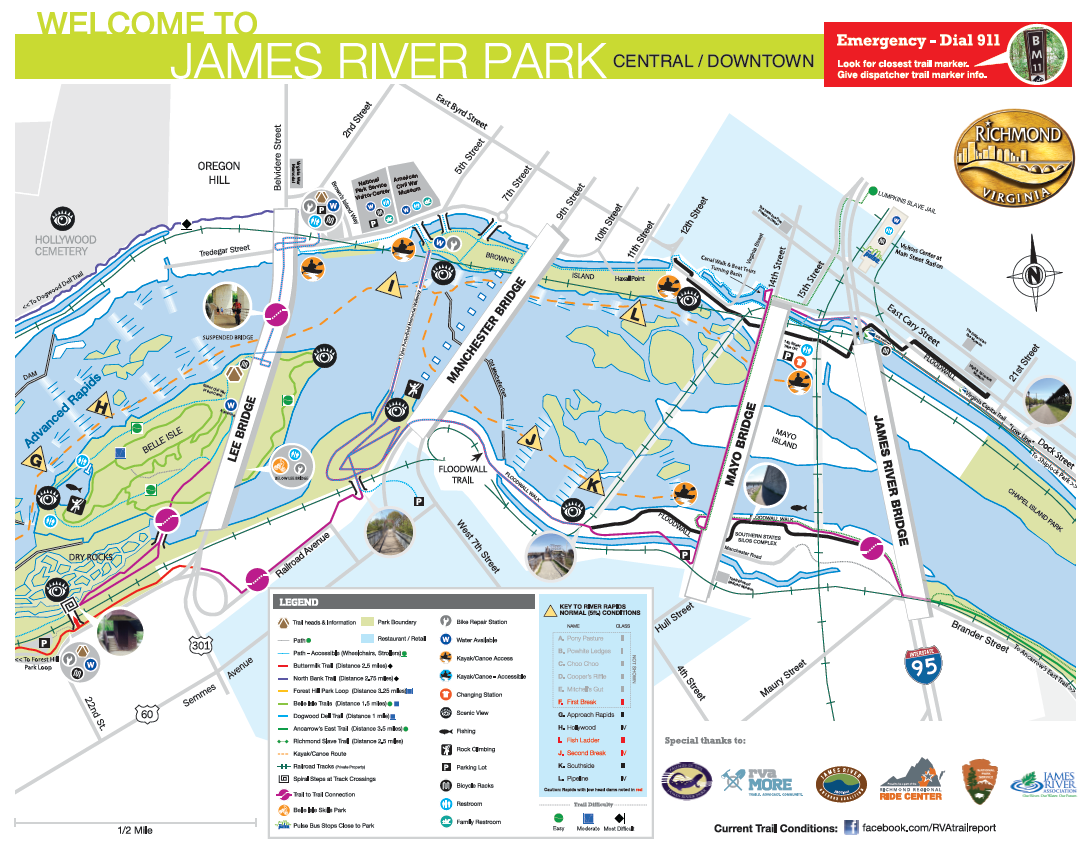
The following shows a map of the more popular trails and other activities in the downtown James River Park System. Right-click the map and select “Save As” to download a copy of the map.
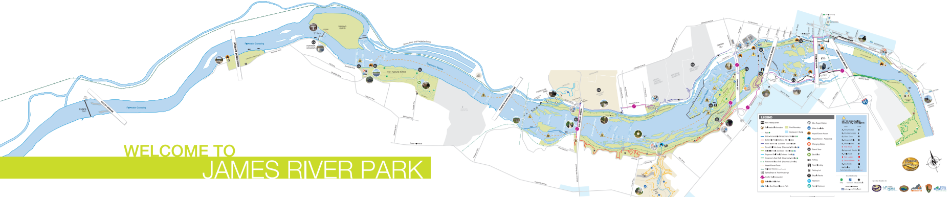
Click on the following larger scale map of the James River Park System to view the river access points to the west of the Boulevard Bridge (aka Nickel Bridge) and the Pony Pasture area: Map of the James River Park System.